檔案:Hawaii Islands.PNG
Mò cho-tet thì-kiûng ke hàn kha-kô fûn-phièn-sut.
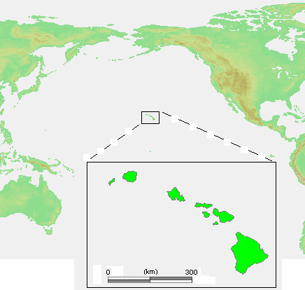
Hawaii_Islands.PNG (436 × 414 chhiong-su, vùn-khien thai-séu: 26 KB, MIME lui-hîn: image/png)
Vùn-khien sot-mìn

|
本圖片是以PNG、GIF或JPEG格式上傳。然而,其中包含的資料或訊息,應該重新建立成可縮放向量圖形(SVG)檔案,以更有效率或更準確的方式儲存。如有可能,請上傳本圖片的SVG格式版本。在上傳之後,請修改維基各姊妹計畫中所有使用舊版圖片的條目(列在圖像連結章節中),替換為新版圖片,並在舊圖片的描述頁中加入{{Vector version available|新圖片名稱.svg}}模板,同時移除本模板。
|
| Mèu-sut | Hawaii Islands.PNG |
| Lòi-ngièn | own work based on PD map |
| Chok-chá | edited by M.Minderhoud |
| Khièn-han: (Chhùng-yung liá-chak tóng-on) |
PD-demis |
| 其他版本 | Derivative works of this file: Hawaii Islands sm.PNG |
Su-khièn
This image is in the public domain because it came from the site https://www.demis.nl/products/web-map-server/examples/ and was released by the copyright holder. Permission is granted to copy, distribute and/or modify this map since it is based on free of copyright images from: www.demis.nl. See also approval email on de.wp and its clarification.
|
| This work has been released into the public domain by its copyright holder, www.demis.nl. This applies worldwide. 這可能在某些國家不合法,如果是的話: www.demis.nl授予任何人有權利使用此作品於任何用途,除受法律約束外,不受任何限制。
|
Vùn-khien li̍t-sṳ́
Tiám-khim ngit-khì / sṳ̀-kiên lòi chhà-khon tông-sṳ̀ chhut-hien-ko ke vùn-khien.
| Ngit khì / Sṳ̀-kiên | Suk-lio̍k-thù | Vì-thu | Yung-fu | Yi-kien | |
|---|---|---|---|---|---|
| tông-chhièn | 2006年7月23日 (Ngit) 13:26 | | 436 × 414(26 KB) | Michiel1972 | {{Information |Description= {{subst:PAGENAME}} |Source= own work based on PD map |Date= |Author= edited by M.Minderhoud |Permission= {{PD-Demis}} |other_versions= }} category:Locator maps of islands |
Vùn-khien yung-chhú
Mò ya̍p-mien lièn-chiap to pún vùn-khien.
Chhiòn-vet tóng-on sṳ́-yung chhong-khóng
Hâ-lie̍t khì-thâ Wiki chûng sṳ́-yung liá-chak tóng on:
- de.wikipedia.org ke sṳ́-yung chhong-khóng
- en.wikipedia.org ke sṳ́-yung chhong-khóng
- es.wikipedia.org ke sṳ́-yung chhong-khóng
- et.wikipedia.org ke sṳ́-yung chhong-khóng
- fr.wikipedia.org ke sṳ́-yung chhong-khóng
- lt.wikipedia.org ke sṳ́-yung chhong-khóng
- pl.wiktionary.org ke sṳ́-yung chhong-khóng
- ru.wikibooks.org ke sṳ́-yung chhong-khóng
- tt.wikipedia.org ke sṳ́-yung chhong-khóng